 Coverage Pro RF
Real terrain. Real antennas. Real answers.
You've got a site picked out, an antenna in mind, and a customer who wants to know if it's going to work. Coverage Pro RF gives you that answer — fast — using actual terrain data and the same Longley-Rice propagation model the industry has relied on for decades.
No cloud accounts. No subscriptions to forget about. Just a straightforward tool that does what you need it to do.
Coverage Maps That Mean Something
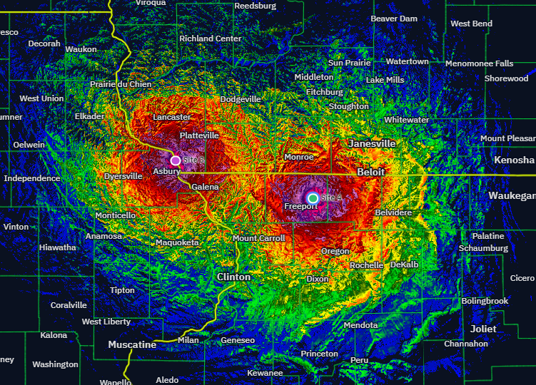
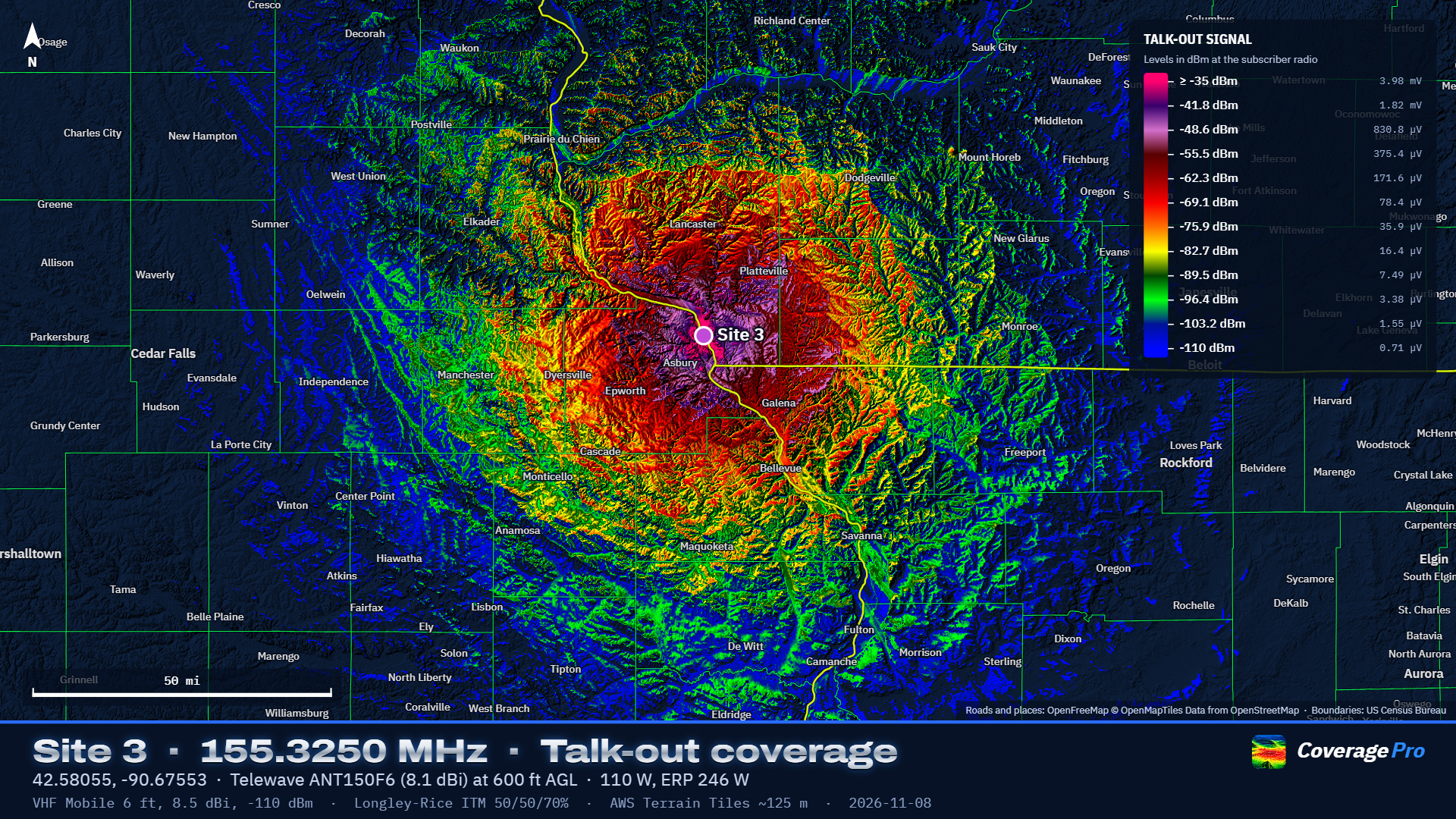
Plot talk-out, talk-in, or both-ways coverage from any repeater or base station. Set your frequency, your antenna, your power and feedline loss — and let the software do the rest. You get a coverage map over real terrain, not a circle on a napkin.
- Talk-out — where can subscribers hear the repeater?
- Talk-in — where can the repeater hear subscribers?
- Both-ways — only the areas where two-way communication actually works
- System coverage — combined maps across linked repeater networks
Adjust the radius, the detail level, and the color scheme. Change the map styling without re-running the whole calculation. When it looks right, export a presentation-quality map sheet ready for a proposal, a license application, or a county board meeting.
Terrain Data You Can Trust
Coverage Pro RF pulls elevation data from the USGS 3DEP program — that's lidar-derived bare earth data down to 1-meter resolution across most of the US. For areas outside the US or where lidar isn't available yet, it falls back to 30-meter worldwide terrain tiles. You can also load your own SRTM .hgt files if you've got them.
Optional land cover data from the USGS National Land Cover Database adds trees and buildings into the prediction. You can model them as obstructions that block the path, or as clutter loss at the subscriber end — whichever fits your situation better.
The Propagation Model
Under the hood is the Longley-Rice Irregular Terrain Model (ITM 1.4), implemented from the NTIA reference code. It's the US standard for VHF and UHF terrain propagation, valid from 20 MHz to 20 GHz and out to 2,000 km.
For every path, the model examines the terrain profile, finds the radio horizons, and blends line-of-sight, diffraction, and troposcatter losses. You control the ground type, radio climate, surface refractivity, and how conservative you want the prediction to be.
We're not going to tell you it replaces a site visit. It doesn't know about the metal building next to your tower or the noise floor at your receiver. But it does give you a solid, terrain-based starting point — and it'll keep you from wasting a trip to a site that was never going to work.
Antennas — Not Just a Name on a List
The built-in antenna library includes real models from Telewave, Sinclair, Decibel Products, Comet, Diamond, dbSpectra, Laird, Hustler, and others. Each one carries its published gain for every band it covers, and the software automatically matches the gain to your site's frequency.
Here's what sets it apart: omni antennas aren't modeled as a simple donut. Coverage Pro RF builds each omni as a stack of half-wave dipoles, fitted to match the manufacturer's published gain and beamwidth. That means you get realistic main lobes, side lobes, and nulls — especially under those high-gain sticks where the pattern actually matters.
For directional antennas, you get full control over azimuth, beamwidth, front-to-back ratio, and tilt. Load a measured pattern file (Planet/MSI or .ant format) if you've got one. The Aim Antenna tool calculates the bearing to a target and shows you the path so you can verify clearance before you climb.
Build up your own antenna library over time. Save, rename, edit, and share antennas between projects or between computers with a simple JSON export.
Interference Studies
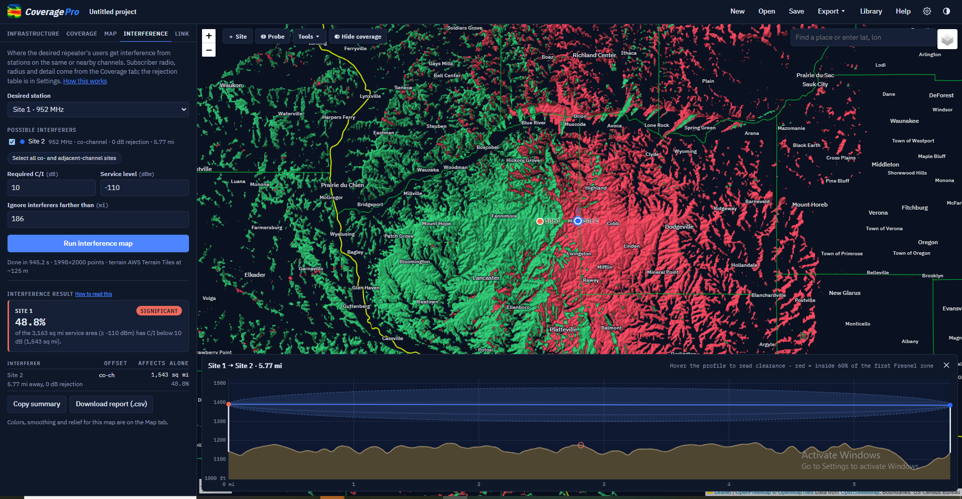
Running a new frequency? Coverage Pro RF maps co-channel and adjacent-channel interference so you can see where your proposed site steps on existing systems — or where they step on you.
The interference map shows your protected service area, the overlap zones, and the carrier-to-interference ratio across the coverage area. Export the results as a CSV report or copy a summary paragraph straight into an email to the coordinator.
Point-to-Point Link Analysis
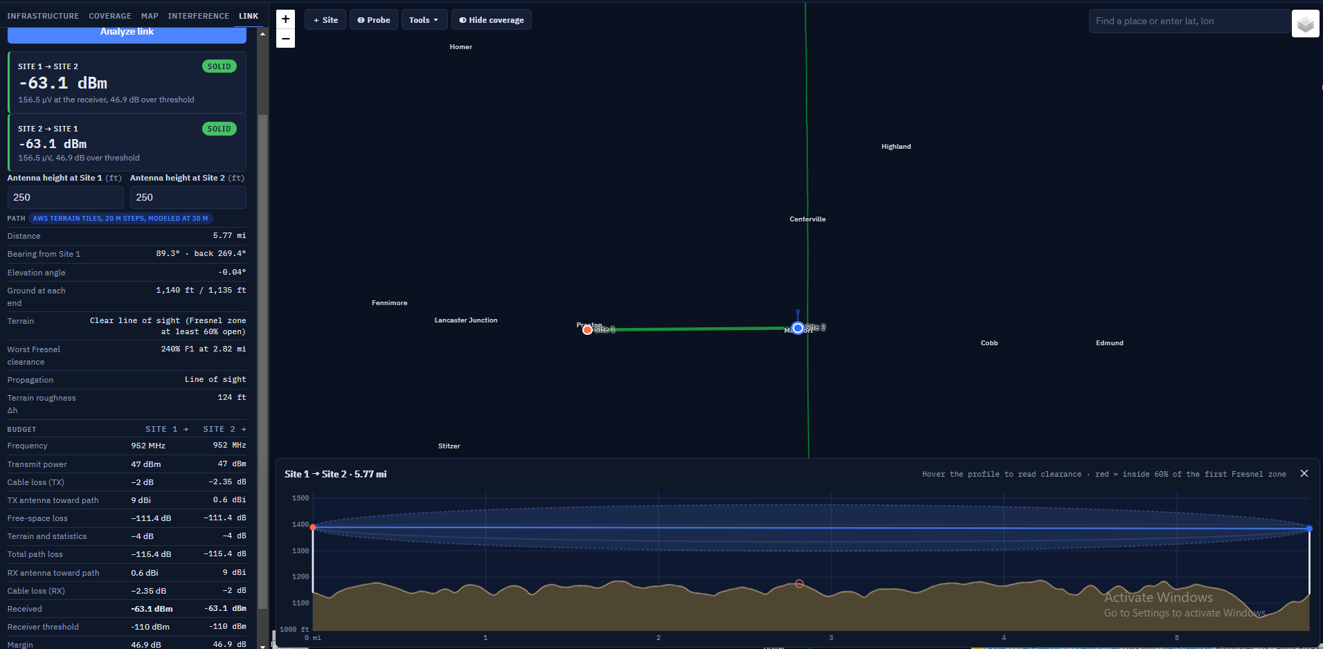
Pick two sites and get a full terrain profile with Fresnel zone clearance, path loss, and a complete link budget in both directions. It's the quick sanity check before you commit to a backhaul path or a fixed link to a remote site.
Get It Out the Door
When the analysis is done, you need to hand it to someone. Coverage Pro RF gives you several ways to do that:
- Presentation map sheets — finished PNG images with legend, scale bar, and caption, sized for screens, letter paper, or 11×17
- Google Earth files (.kmz) — coverage overlays and site placemarks your field crew can pull up on a phone
- Batch maps — generate finished maps for dozens of repeaters at once, complete with a searchable gallery page
- CSV exports — site lists and interference reports ready for a spreadsheet
Built for the Way You Work
- Import sites from a CSV file — compatible with RepeaterBook exports
- Measure distances and bearings right on the map
- Probe any point to read the predicted signal level
- Drop range rings around a site
- Save layers and come back to compare antenna options side by side
- Magnetic bearing readout using the current WMM2025 model
Who It's For
Coverage Pro RF was built for people who already know what a duplexer does. If you're a two-way radio shop quoting a system, a wireless ISP planning a tower, or a county emergency manager trying to figure out where the dead spots are — this is the tool that gets you from “I think this will work” to “here's the map that proves it.”